Overview
Measuring poverty is difficult. At the moment it involves conducting household surveys in faraway places. While these surveys are detailed, they are also slow, expensive and have limited coverage. There may be a better way.
This project, with Brock Smith and Thomas McGregor, proposes a new way to measure rural poverty: by using satellites to count the number of people who live in darkness at night. This is intuitive: households will turn on the lights soon after they leave extreme poverty because of the huge returns to a longer working day. It is also fast, cheap, accurate, and covers the entire world at up to 1km2 resolution, making it well-suited to comparing poverty across space and time.
For more detail on the measure, including evidence that it accurately identifies up to 83% of households as above or below the extreme poverty line when compared to 600,000+ household surveys, please reference:
Left in the Dark? Oil and Rural Poverty (2018) with Smith, B., Journal of the Association of Environmental and Resource Economists (JAERE), 5(4)
- Awarded the Ralph C. d’Arge and Allen V. Kneese Award for the best paper in JAERE in 2018
For an application that shows how surfing (…yes, surfing…) can help reduce rural poverty see:
Do natural amenities promote growth? Evidence from surf breaks with McGregor, T., OxCarre Working Paper No. 170, University of Oxford
Media coverage: Today Program, BBC Radio 4 (permanent link); Hindustan Times; Manila Times; University of Oxford; Phys.org; The Atlantic; University of Sydney; Canadian Broadcasting Corporation – interviewed on 24 radio stations (16/08/2016)
Rural Poverty Maps
We hope this measure will be useful. Aid agencies may find it helpful for allocating aid and targeting interventions. Researchers may use it to study poverty, making use of its high level of geographic detail and global coverage at regular intervals (the dataset is a globally balanced panel).
Below are some examples of rural poverty maps that can be generated using the data. For bespoke maps or any questions please get in contact.
*Maps show (in red) the population density (population/km2) living in darkness at night. Images created by Thomas McGregor.
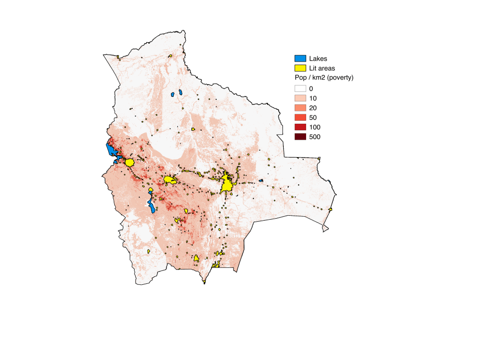
Rural Poverty Map: Bolivia, 2010
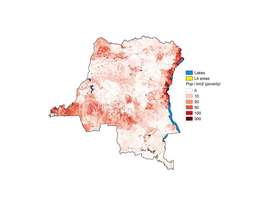
Rural Poverty Map: Democratic Republic of Congo, 2010
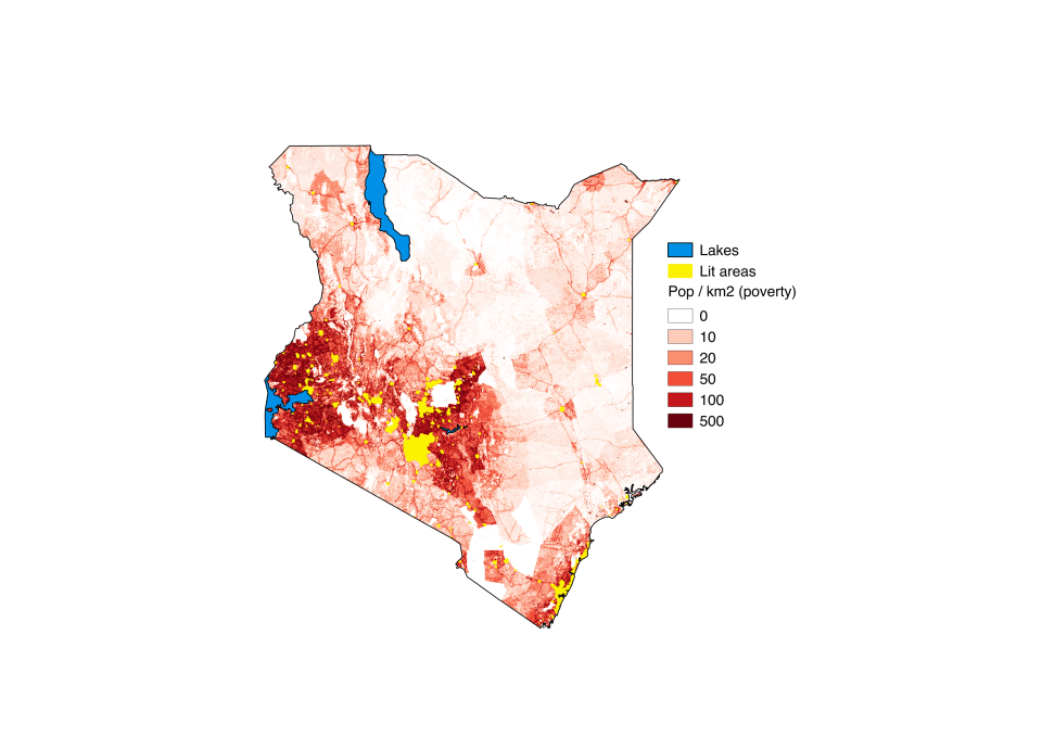
Rural Poverty Map: Kenya, 2010
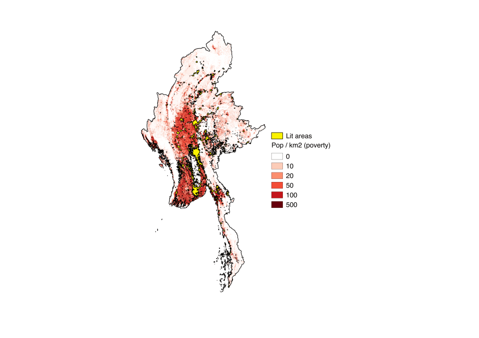
Rural Poverty Map: Myanmar, 2010
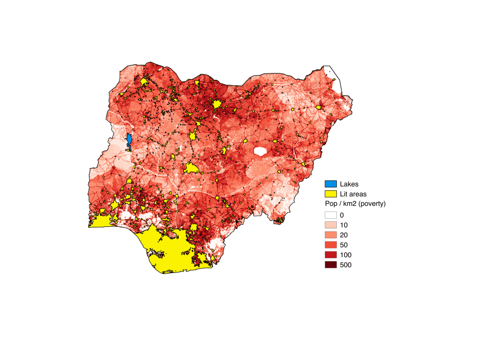
Rural Poverty Map: Nigeria, 2010
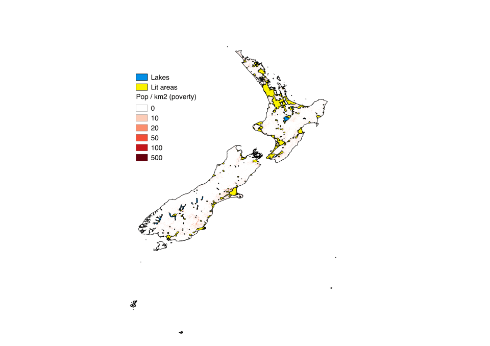
Rural Poverty Map: New Zealand, 2010

Rural Poverty Map: Rwanda, 2010
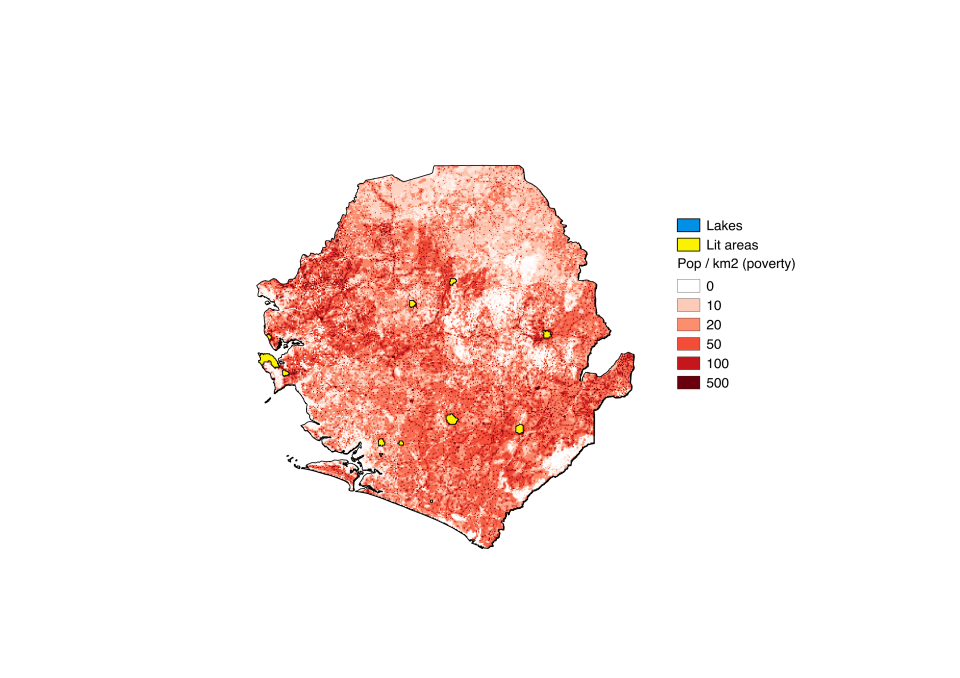
Rural Poverty Map: Sierra Leone, 2010
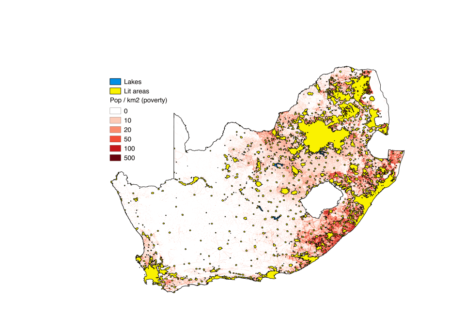
Rural Poverty Map: South Africa, 2010
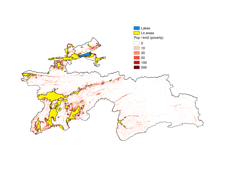
Rural Poverty Map: Tajikistan, 2010
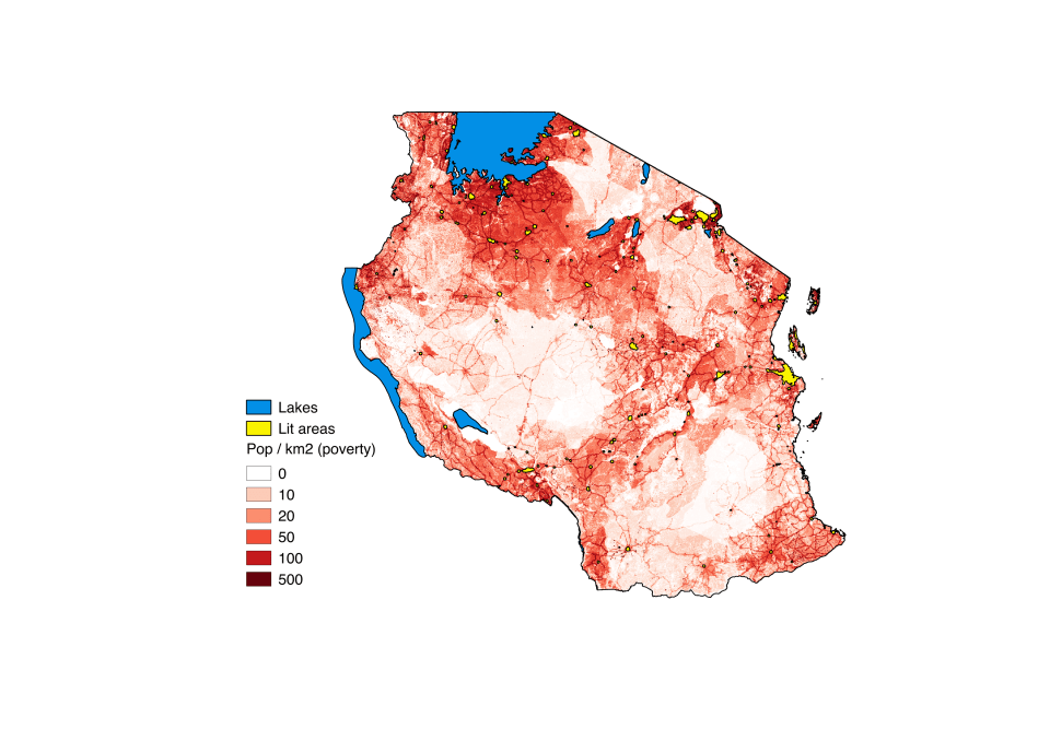
Rural Poverty Map: Tanzania, 2010
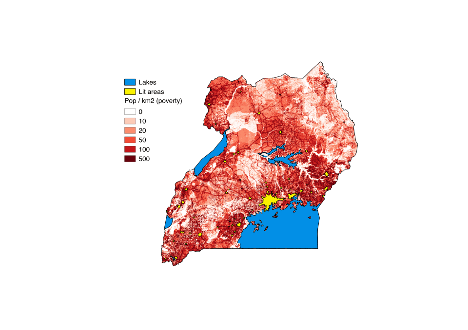
Rural Poverty Map: Uganda, 2010
